[The Wey-South Path]
[The Essex Way]
[Links]
[Stour & Orwell]
[Thanet Coast Path]
[Grand Union]
[Wealdway]
[HWLT]
[SDW]
[Elham]
[Regents Canal]
[1066]
[SSW]
[PW NCP]
[Cotswold]
[SVW]
[DVP]
[SBP]
[Thames]
[SWCP]
[Gipping Valley River Path]
[Speyside]
[Three Castles Path]
[GGW]
[Eden]
[NDW]
[Capital Ring / Parkland Walk]
[MVW]
[The Loop]
[Ridgeway]
[TWC]
[RMCP]
[SMW]
[Fife Coastal Path]
[OVW]
[Vanguard]
[Lea Valley Walk]
[Resources]
[Greensand Way]
[The Monarch's Way]
[E2]
[Sandlings Walk]
[Solent Way]
[Weavers Way]
[Fynn Valley Way]
[Scafell Pike]
[Snowdon]
[Ben Nevis]
[Pentland Hills]
[Hangers Way]
[Staunton Way]
[Downs Link]
[Airdrie Bathgate Cycle Path]
[Thames Down]
[Marriot's Way]
[Bournemouth Coast Path]
[Forest Way]
[Icknield Way]
[Suffolk Coast Path]
[Angles Way]
[River Parrett Trail]
[New River Path]
[Stour Valley Path]
[St Edmund Way]
[Centenary Walk]
[John Muir Way]
[Paston Way]
[East Mendip Way]
[Orford Ness]
[Lindisfarne]
[Southern Upland Way]
[Berwickshire Coastal]
[Beverley Brook Walk]
[Chess Valley Walk]
[West Mendip Way]
[Strawberry Line]
[Colne Valley Trail]
[Hillingdon Trail]
[Huddersfield Canal Towpath Walk]
[Trans Pennine Trail]
[Pennine Way]
[North Berwick Law]
[Green Chain Walk]
[Ridgeway London]
[Waterlink Way]
[Greenwich Meridian Trail]
[Shuttle Riverway]
[Kelvin Walkway]
[Clyde Walkway]
[Union Canal Walk]
[New Lipchis Way]
[Brent River Park Walk]
[Dog Rose Ramble]
[Pymme's Brook Trail]
[Dollis Valley Greenwalk]
[Wandle Trail]
[Celandine Route]
[Paths to Prosperity]
[Snaefell]
Snaefell |

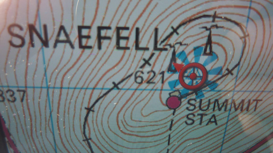
Snaefell is the highest mountain and the only summit higher than 2,000 feet (610 m) on the Isle of Man, at 620 metres (2,034 ft) above sea level. The summit is crowned by a train station, cafe, and several communications masts. (source Wikipedia)
Laxey to Bungalow
Tuesday 1 May 2012 - 3.5 Miles
ID01052012#23
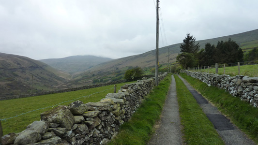
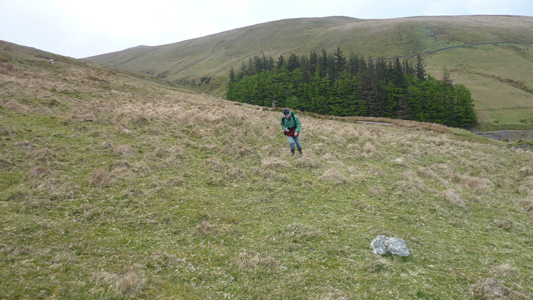
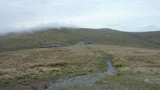
This was walked with my father, so first I walked to his B&B near us in Douglas, then caught the Bus Vannin to Laxey (as you do). Anyhow, at Laxey we then followed the Mines Road by the side of the Laxey Wheel (visited on another day) and followed this steeply ascending metalled track to Agneash, where the way then becomes a rough track, following the right hand side of the valley inland towards Snaefell, with the river Laxey River between us and the Mountain Railway on the left side of the valley. Passing through Laggan Agneash (nothing except old mining ruins) and with the only sound being bleating lambs (ahh) and the distant sound of traffic on the road at Bungalow, we soon reached the main abandoned mining complex, where we then had to scramble on the steep slope up to the A18 Bungalow Road, and had to try to bear towards where the mountain railway crosses at the base of Snaefell proper, as being part of the TT circuit it is not much fun walking along the road here. It was hard going with many streams and boggy bits to cross and then it started to pour with rain, so by the time we reached the road, even though it was not a long walk we were fluxed. Fortunately my mate stain rolled up with the Focus from Douglas and rescued us to then finish the climb the next day
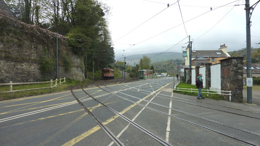
Laxey. Mountain Railway crossing. We followed the Mines Road, passing by the Laxey Wheel just in the distance
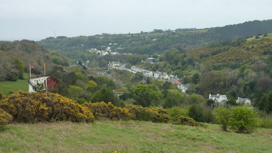
Looking back to the Laxey Wheel and Laxey Village from near Agneash
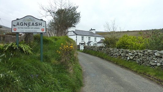
Entering the tiny village of Agneash
Looking towards Snaefell in middle
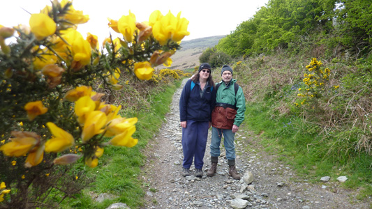
A quick photo op with the Dad, gorse muscling in on the action
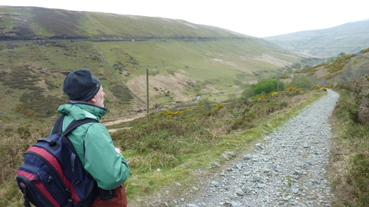
A moment of contemplation, as the way becomes a rough track
not much left of this gaff
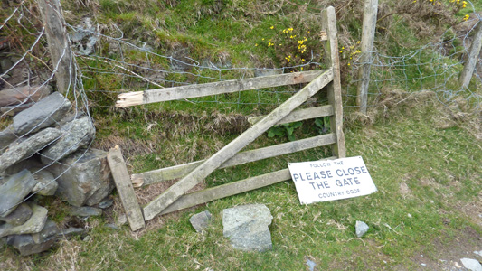
Gate - Fail
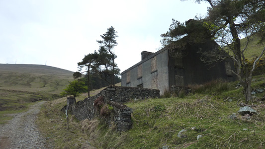
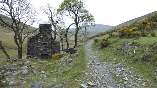
Old mine dwelling with Snaefell behind
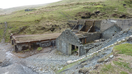
More old Mine remains
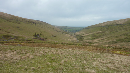
View back towards Laxey and the coast, our track on left, mountain railway higher, on right
Looks simples, but it was a slog up to the road at Bungalow
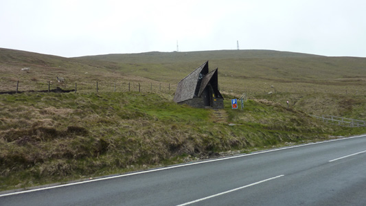
A rescue hut on the road near Bunglalow. Fortunately the Focus rolled up and we were whisked (soggily) back into Douglas
Bungalow to Snaefell (Summit)
Wednesday 2 May 2012 - 0.75 Miles
ID02052012#24
The first part of todays wild adventure was buying a supermultipass for the Railways, and a nice trip was had on the Manx Electric from Douglas to Laxey, the changing onto the Mountain Railway, where the Dad n me jumped ship at Bungalow and my mate stain carried on up to the Summit and waited at the restaurant, busily eating a cream tea when our carcassed finally arrived. From Bungalow it is not a big deal to reach the summit, except that frequently it gets foggy, and if not for my GPS it would have been a bit hit and miss arriving directly at the combined station / restaurant complex. Anyway, just a rough track soon gets you up top and a short walk along a concrete path brings you to the trig point and summit - however on this occasion we could hardly see back to the station, let alone another country, as you should ideally be able to see Scotland, Wales, Ireland etc... anyway, job done
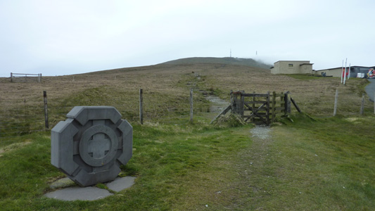
At Bungalow, after bailing out of the train, a straight shot to the summit
A view back to Bungalow. Just watched the TT for the first time on ITV4 and they come through here in a blur
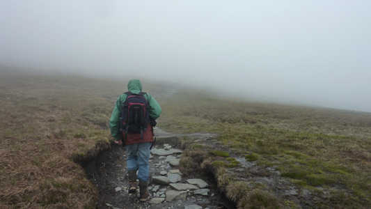
Crivens, where's the summit?
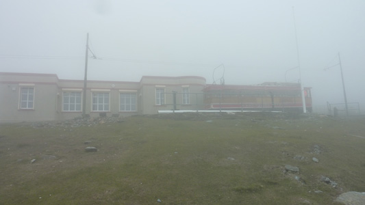
Ahh..the station and restaurant (at the end of the mountain) we had some great scoff while waiting to go back down
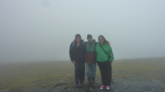
We prised the stain away from her cream tea and she joined us for the very underwhelming view at the trig point
Just to check, my sat nav confirmed our position...job done
