[The Wey-South Path]
[The Essex Way]
[Links]
[Stour & Orwell]
[Thanet Coast Path]
[Grand Union]
[Wealdway]
[HWLT]
[SDW]
[Elham]
[Regents Canal]
[1066]
[SSW]
[PW NCP]
[Cotswold]
[SVW]
[DVP]
[SBP]
[Thames]
[SWCP]
[Gipping Valley River Path]
[Speyside]
[Three Castles Path]
[GGW]
[Eden]
[NDW]
[Capital Ring / Parkland Walk]
[MVW]
[The Loop]
[Ridgeway]
[TWC]
[RMCP]
[SMW]
[Fife Coastal Path]
[OVW]
[Vanguard]
[Lea Valley Walk]
[Resources]
[Greensand Way]
[The Monarch's Way]
[E2]
[Sandlings Walk]
[Solent Way]
[Weavers Way]
[Fynn Valley Way]
[Scafell Pike]
[Snowdon]
[Ben Nevis]
[Pentland Hills]
[Hangers Way]
[Staunton Way]
[Downs Link]
[Airdrie Bathgate Cycle Path]
[Thames Down]
[Marriot's Way]
[Bournemouth Coast Path]
[Forest Way]
[Icknield Way]
[Suffolk Coast Path]
[Angles Way]
[River Parrett Trail]
[New River Path]
[Stour Valley Path]
[St Edmund Way]
[Centenary Walk]
[John Muir Way]
[Paston Way]
[East Mendip Way]
[Orford Ness]
[Lindisfarne]
[Southern Upland Way]
[Berwickshire Coastal]
[Beverley Brook Walk]
[Chess Valley Walk]
[West Mendip Way]
[Strawberry Line]
[Colne Valley Trail]
[Hillingdon Trail]
[Huddersfield Canal Towpath Walk]
[Trans Pennine Trail]
[Pennine Way]
[North Berwick Law]
[Green Chain Walk]
[Ridgeway London]
[Waterlink Way]
[Greenwich Meridian Trail]
[Shuttle Riverway]
[Kelvin Walkway]
[Clyde Walkway]
[Union Canal Walk]
[Lipchis Way]
Ridgeway London

The covered sewer forms the southern boundary of Thamesmead and has been landscaped as an elevated footpath called the Ridgeway (similar to The Greenway built over the Northern Outfall Sewer).
Crossness Pumping Station to Broadwater
Saturday 10 December 2011 - 3.5 Miles
ID10122011#21b
So, you would assume this to be a walk with not much to redeme itself, running above a big pipe of shite - but in principle it should have been a good walk due to the elevated nature (similar to an old railway embankment) and with the Victorian history - but in practice, unlike the Northern Outfall Sewer previously encountered on the Capital Ring, this walk seems to have been seriously neglected of late and is not contigous between the Thames at Crossness and Thamesmead due to some works near the pumping station, preventing you getting through by the Golf Course - BUT, all that is needed is for the selfish golf course to have erected a narrow corridor of Heras Fencing to keep this way open, so I had to take a parallel route running north of the Golf Course to reach the Thames, after retracing my steps from the pumping station, then walked as far along the golf course perimeter as possible, for completeness sake, then walk back on this circuitous route to the Green Chain Junction and then walk West towards Plumstead - Good views over Thamesmead and Abbey Wood and the wider environs, but rather disconcerting regular placement of CCTV. At Plumstead the Sewer proper is left, and there is street walking to reach the Broadwater, just adjacent to Whinchat Road, which is then followed to the Thames, a fascinating remnant of the Royal Arsenal Canal. So, there was quite a bit of industrial archeology on show, but the whole route desperately needs to be revamped and made more cohesive, as it is particularly grotty near Plumstead Station and is a wasted opportunity
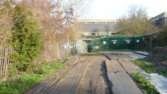
This is where I tried following up from the Green Chain to Crossness to start the walk. You should be able to go through the kissing gate to the left of the green Murphy barriers, but the way through is blocked that leads onto the golf course, so I had to take a circuit round to the north to reach the Thames starting point
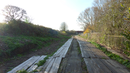
Retracing my steps back to the Green Chain underpass - Bah!
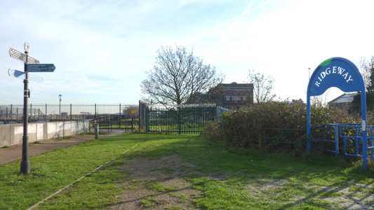
This is what is supposed to be the starting point at Crossness - junction with Thames Path Extension. I remembered this junction from when I did that walk years ago - whether the path was compromised in 2008 I don't know
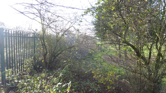
I tried to follow from the blue Ridgeway sign back towards Thamesmead, but you only get about 100metres before a patch of trees, however you could deviate round these to the right, but then are running the wrath of the numerous golfers on the fairway - so I had to admit defeat this time, and go all the way back round to the Green Chain underpass / A2016 again
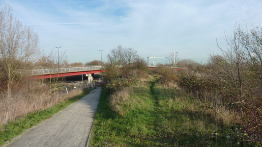
When I had finally made it back to the Green Chain / A2016 underpass, one last look back towards Crossness
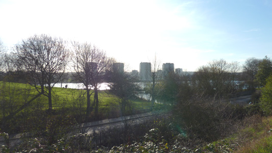
Southmere from the Ridgeway
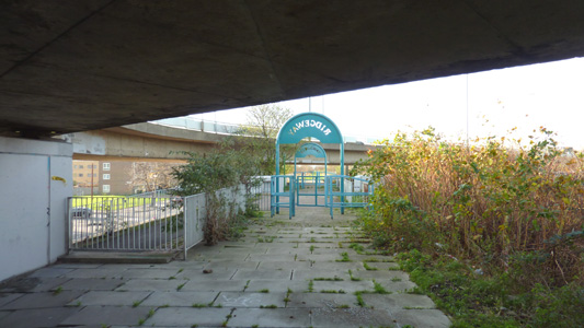
Passing under the A2016 / Harrow Manorway
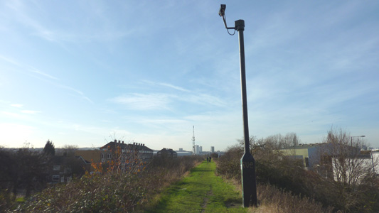
Rather disconcerting CCTV mast
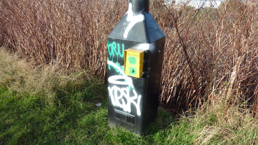
Even more sinister - a help point - a first for me on a walk!
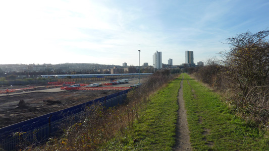
Plumstead beckons...
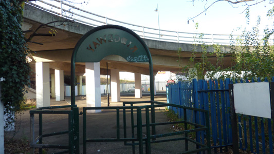
Just across the road from the station at Plumstead you come off the Sewer and with the aid of zero waymarking navigate through the concrete underpass
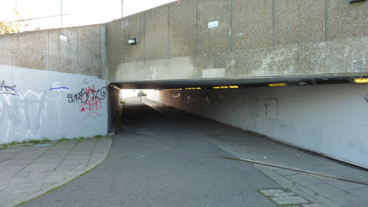
Very Clockwork Orange Underpass off Plumstead Road - where's the hobo asking 'Can You Spare Some Cutter, Me Brothers?'
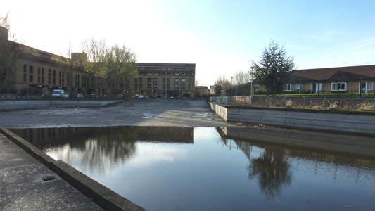
The truncated end of the Royal Arsenal Canal - widened and concreted - off Whinchat Road
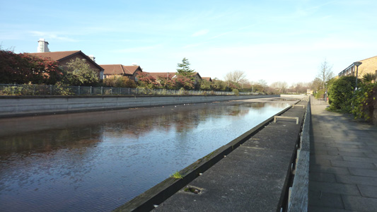
The sanitised canal - almost dry presumably to avoid drowning kiddiwinks?
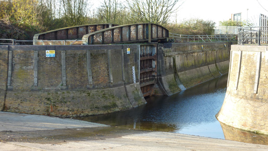
Intriguing remains of lock and swingbridge just by Thames
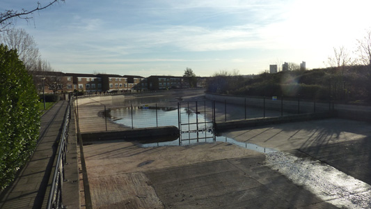
Looking back from disused lock towards the truncated end - what the gate and concrete barrier is for gawd knows
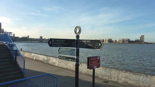
Finally at the Thames - The Ridgeway is mentioned here as well but there is no waymarking between Plumstead and here
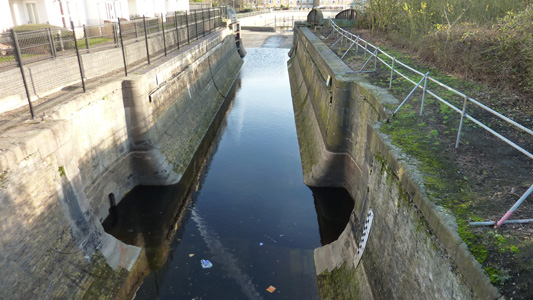
Looking back to the remains of the lock and swingbridge. I then walked back to Plumstead Station to take the link path to the Green Chain Walk
