[The Wey-South Path]
[The Essex Way]
[Links]
[Stour & Orwell]
[Thanet Coast Path]
[Grand Union]
[Wealdway]
[HWLT]
[SDW]
[Elham]
[Regents Canal]
[1066]
[SSW]
[PW NCP]
[Cotswold]
[SVW]
[DVP]
[SBP]
[Thames]
[SWCP]
[Gipping Valley River Path]
[Speyside]
[Three Castles Path]
[GGW]
[Eden]
[NDW]
[Capital Ring / Parkland Walk]
[MVW]
[The Loop]
[Ridgeway]
[TWC]
[RMCP]
[SMW]
[Fife Coastal Path]
[OVW]
[Vanguard]
[Lea Valley Walk]
[Resources]
[Greensand Way]
[The Monarch's Way]
[E2]
[Sandlings Walk]
[Solent Way]
[Weavers Way]
[Fynn Valley Way]
[Scafell Pike]
[Snowdon]
[Ben Nevis]
[Pentland Hills]
[Hangers Way]
[Staunton Way]
[Downs Link]
[Airdrie Bathgate Cycle Path]
[Thames Down]
[Marriot's Way]
[Bournemouth Coast Path]
[Forest Way]
[Icknield Way]
[Suffolk Coast Path]
[Angles Way]
[River Parrett Trail]
[New River Path]
[Stour Valley Path]
[St Edmund Way]
[Centenary Walk]
[John Muir Way]
[Paston Way]
[East Mendip Way]
[Orford Ness]
[Lindisfarne]
[Southern Upland Way]
[Berwickshire Coastal]
[Beverley Brook Walk]
[Chess Valley Walk]
[West Mendip Way]
[Strawberry Line]
[Colne Valley Trail]
[Hillingdon Trail]
[Huddersfield Canal Towpath Walk]
[Trans Pennine Trail]
[Pennine Way]
[North Berwick Law]
[Green Chain Walk]
[Ridgeway London]
[Waterlink Way]
[Greenwich Meridian Trail]
[Shuttle Riverway]
[Kelvin Walkway]
[Clyde Walkway]
[Union Canal Walk]
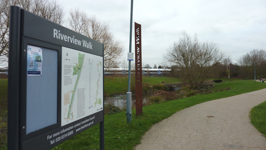
Waterlink Way
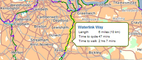
The Waterlink Way is a long distance cyclepath and walking route. It leads from The Cutty Sark ship in Greenwich to Cator Park, New Beckenham a length of 7 miles. The Waterlink Way connects a number of parks and green spaces in South East London while following the Pool River and Ravensbourne River. The route was designed to be very accessible, with a large number of railway stations on route. Including Greenwich, Leisham, Ladywell, Catford, Kent House. In Cator Park, the cycle/walking path links with the Capital Ring and Green Chain Walk, but is also waymarked onwards as the Waterlink Way to at least South Norwood Country Park so the jury is out!
Cutty Sark (Greenwich) to Catford
Saturday 10 December 2011 - 3.5 Miles
ID10122011#21d
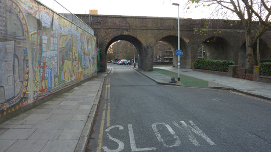
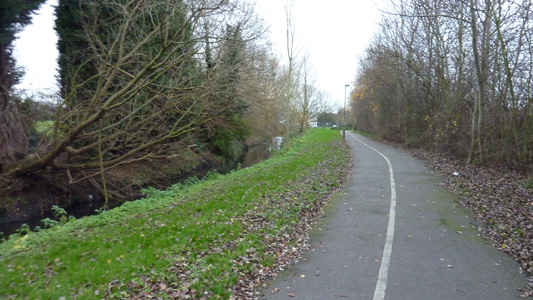
This was the last bit of walking today, and was the only non contigious part, as I had caught a bus from Charlton to Woolwich where I had just finished the Green Chain Walk - this walk was almost not started, as I had intended to be here at least an hour earlier, but a combination of getting up late and problems with the Ridgeway meant it was starting to near dusk when I started, but just decided to go as far as I could - eventually I called it quits at Catford Station as it was getting too dark and I was about half way through the walk. I actually found this the most agreeable walk today, as even though this is principally marketed as a SUSTRANS cycle route (21) it is very pleasant on foot, as you follow the Ravensbourne, and pass through many linear parks and transport links are top notch. From Deptford Creek Swing Bridge / Thames you head south, through Deptford, St Johns, Lewisham, Ladywell and Catford, with some minor lane walking but mainly off road. A lot of construction work at Deptford Creek where it is all being 'poshed up'
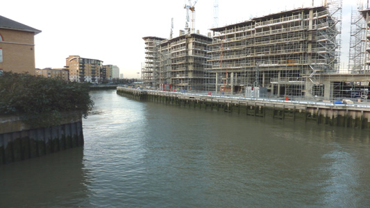
Deptford Creek and construction
The main intersection - North to Thames and Peter The Great Statue, South towards Lewisham
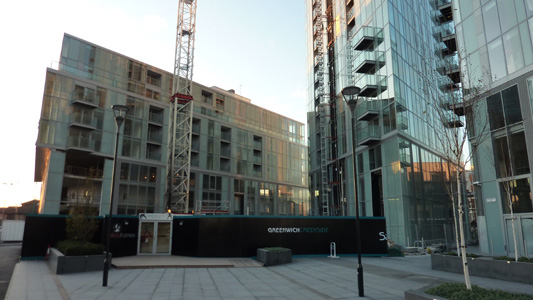
Trendy Development - Copperas Street
A well done but slightly disturbing Mural - Creekside
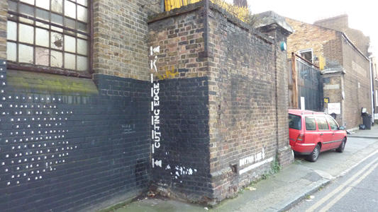
I had been warned to look out for humour from online resources describing this walk - here is the 'cutting edge' and 'bottom line'
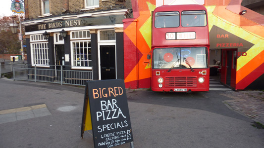
The Birds Nest and old London bus
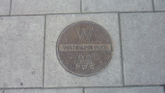
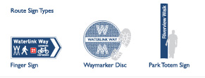
One of the manhole cover type waymarkers seen regularly on street sections
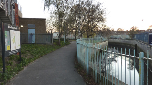
The Ravensbourne at Broadway Fields
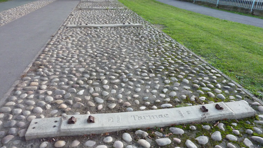
At Deptford Bridge the DLR runs overhead on piers - for some reason these perfectly good sleepers have been cemented in underneath
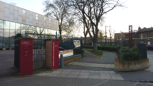
Stephen Lawrence Charitable Trust - Brookmill Road
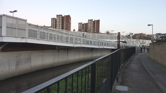
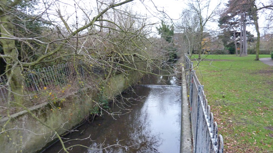
The Ravensbourne at Elverson Road DLR
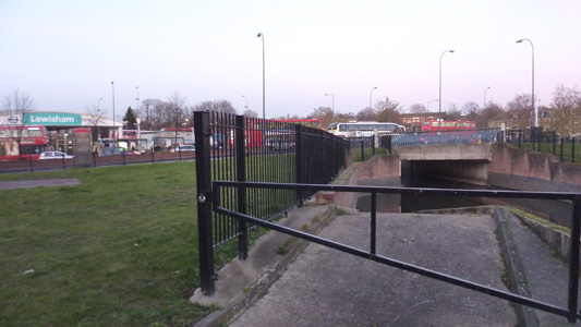
Lewisham
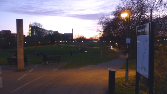
Ladywell Fields - nearly gave up at the station here, but soldiered on to Catford in the dark, this section was actually quite pleasant, passing near the old Catford 'dogs' stadium and finishing with a choice of Catford or Catford Bridge Stations - Catford was best choice for Hastings Line.
Catford to Cator Park (New Beckenham)
Tuesday 27 December 2011 - 2.5 Miles
ID27122011#24
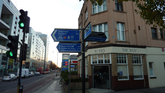
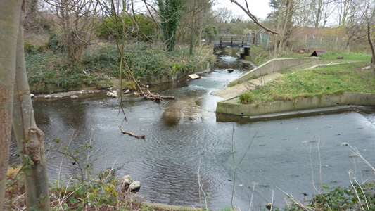
OK, a pitiful distance for a walk, but I then walked another 1.75 Miles to Penge East following the Capital Ring/Green Chain bit that I missed out originally as the parks were closed when doing the route officially - well, still a short walk, but I was meant to get up at 0700 but chassis said No, and only got to Catford at 1400 - but I am quite happy that I actually got a walk in at all....anyway, crossed at Catford Station into The River Pool Linear Park (The Ravensbourne splits off to the Southeast shortly after) and follow this river along the edge of Bellingham into Riverview Walk, soon crossing Southend Lane by a Sainsburys, straight ahead and soon arriving at Lower Sydenham Station, where you have to walk through an industrial estate, before another linear park section by the Pool at New Beckenham, crossing Lennard Road into Cator Park - where the Capital Ring/Green Chain Walk and Sustrans Route 21 to Eastbourne give you route choices onwards
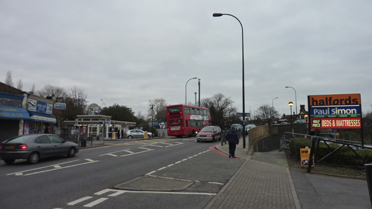
Catford Bridge - If you are really hard up you could go and check out the fibreglass cat at the Shopping Centre
Adios Ravensbourne
Rather pleasant walking, but a bit naff that the river is constricted all through here in a concrete channel
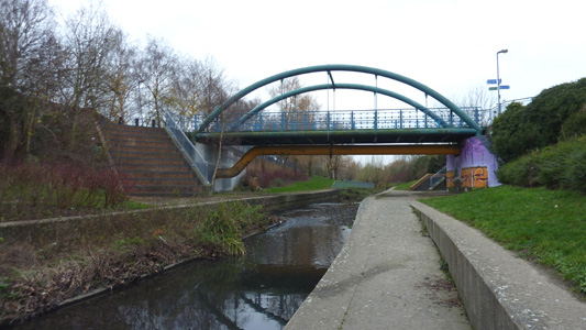
You have to cross this bridge...when you come to it...
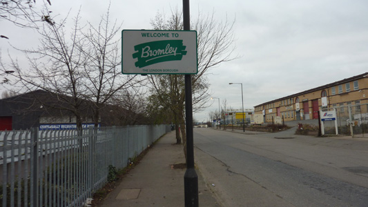
The scenic delights of a Bromley Industrial Estate
Linear by the Pool - New Beckenham
The Pool in Cator Park

Cator Park - Where do you want to go Now? I am a bit confused on the Waterlink Way though, online resources show it ending at New Beckenham, although it is waymarked through Cator Park and this fingerpost shows it carrying on to South Norwood Country Park at least - although I will probably persue route 21 on foot and cycle coz it ends up near me manor at Eastbourne, and looks pretty interesting
