[The Wey-South Path]
[The Essex Way]
[Links]
[Stour & Orwell]
[Thanet Coast Path]
[Grand Union]
[Wealdway]
[HWLT]
[SDW]
[Elham]
[Regents Canal]
[1066]
[SSW]
[PW NCP]
[Cotswold]
[SVW]
[DVP]
[SBP]
[Thames]
[SWCP]
[Gipping Valley River Path]
[Speyside]
[Three Castles Path]
[GGW]
[Eden]
[NDW]
[Capital Ring / Parkland Walk]
[MVW]
[The Loop]
[Ridgeway]
[TWC]
[RMCP]
[SMW]
[Fife Coastal Path]
[OVW]
[Vanguard]
[Lea Valley Walk]
[Resources]
[Greensand Way]
[The Monarch's Way]
[E2]
[Sandlings Walk]
[Solent Way]
[Weavers Way]
[Fynn Valley Way]
[Scafell Pike]
[Snowdon]
[Ben Nevis]
[Pentland Hills]
[Hangers Way]
[Staunton Way]
[Downs Link]
[Airdrie Bathgate Cycle Path]
[Thames Down]
[Marriot's Way]
[Bournemouth Coast Path]
[Forest Way]
[Icknield Way]
[Suffolk Coast Path]
[Angles Way]
[River Parrett Trail]
[New River Path]
[Stour Valley Path]
[St Edmund Way]
[Centenary Walk]
[John Muir Way]
[Paston Way]
[East Mendip Way]
[Orford Ness]
[Lindisfarne]
[Southern Upland Way]
[Berwickshire Coastal]
[Beverley Brook Walk]
[Chess Valley Walk]
[West Mendip Way]
[Strawberry Line]
[Colne Valley Trail]
[Hillingdon Trail]
[Huddersfield Canal Towpath Walk]
[Trans Pennine Trail]
[Pennine Way]
[North Berwick Law]
[Green Chain Walk]
[Ridgeway London]
[Waterlink Way]
[Greenwich Meridian Trail]
[Shuttle Riverway]
[Kelvin Walkway]
[Clyde Walkway]
[Union Canal Walk]
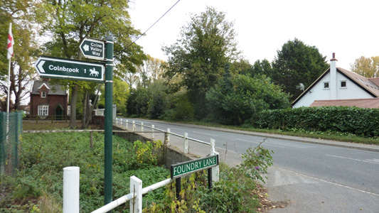
Colne Valley Trail and Colne Valley Way
The Colne Valley Trail starts at Rickmanworth and follows the River Colne southwards ending at Colnbrook. There is a link path to Langley from Cowley Lock. Plans are in hand to extend the Colne Valley Trail further south.
Rickmansworth to Springwell Lock
Sunday 6 March 2011 - 2.5 Miles
ID06032011#2b
This was the second part of the day's walk - for the first part see Chess Valley Walk
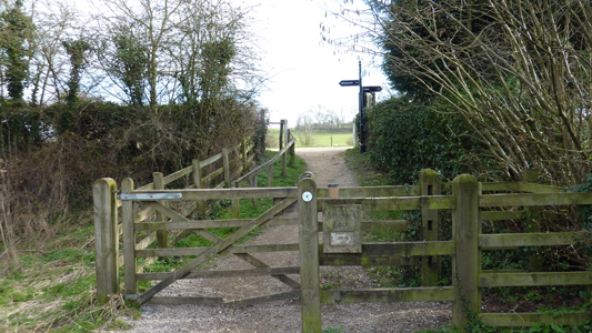
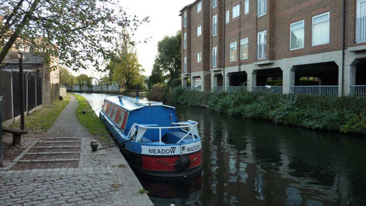
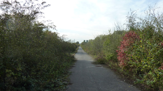
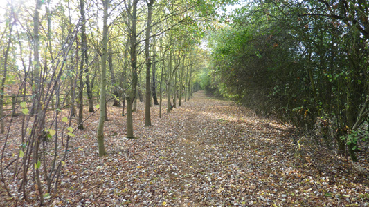
From Rickmansworth I joined the Colne Valley Trail at the Aquadrome a delightful mix of parkland, lakes and a great cafe. Onwards through this area to the nearby Grand Union Canal, which means I also incidentally did another section of The Grand Union Canal Walk - for other parts I have walked click here. I followed along initially on the West Bank, then the East from Springwell Lock when although I was still following the Colne Valley Trail, I was actually sticking to the route of The Hillingdon Trail from then on! I have previously done the section of Colne Valley Trail between here and Yiewsley as part of Grand Union Canal Walk - I hope you get what I'm on about - it basically gets very wierd around walks that combine and leave previously walked sections - i try not to retrace my steps if possible. Anyway this walk was brief and pleasant enough, and I peeled off properly from the Colne Valley Trail as I headed inland to Harefield - this bank of the canal climbing high with nice views, in contrast to the towpath.
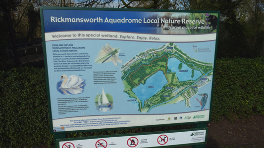
Aquadrome Sign
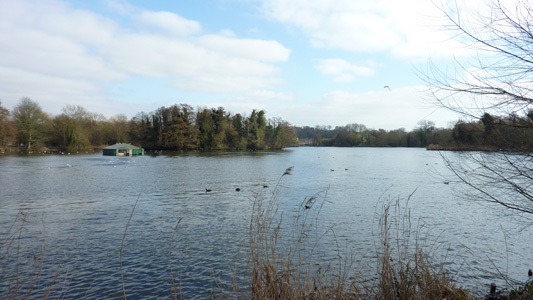
Bury Lake
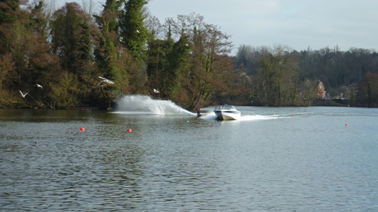
Skiing Shenanigans on Batchworth Lake
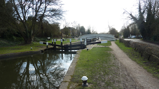
Joining The Grand Union Canal at Stocker's Lock
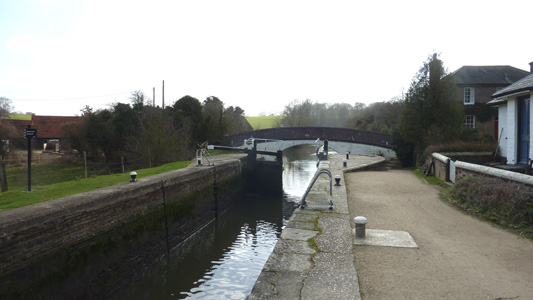
Stocker's Lock
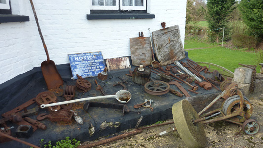
Canal related ephemera at Stocker's Lock
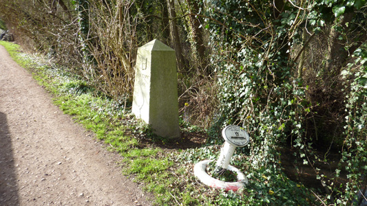
Boundary Marking - between Herts and Hillingdon
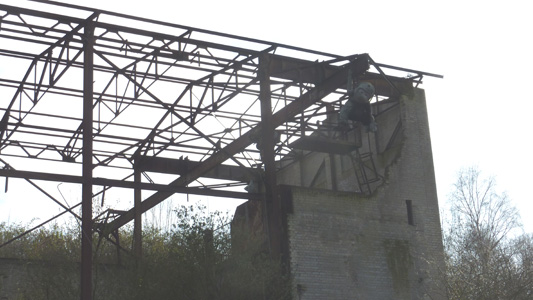
Some weird critter statue type thing on a ruined industrial building - a bit monkey...
Springwell Lock - I changed banks here and paths to the Hillingdon Trail
West Drayton to Staines
Monday 24 October 2011 - 11 Miles
ID24102011#13
A walk to finish the Colne Valley Way and Trail, the trail is supposed to hand over to the way at Colnbrook, but the names were interchanged in several places along the way, so it is easier and more logical to treat it all as the same walk. The other section of the walk was already covered under Hillingdon Trail / Grand Union Canal Walk and London LOOP
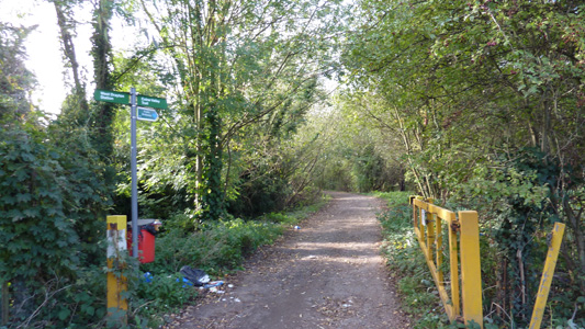
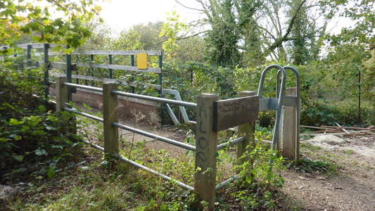
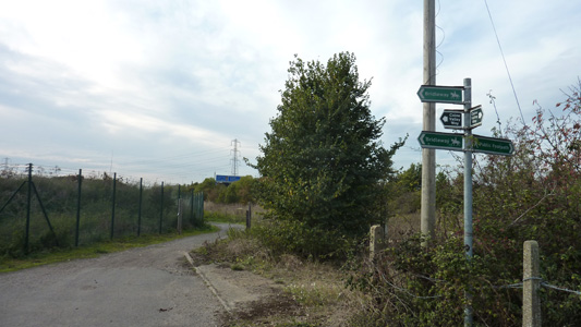
From West Drayton I quickly reached the Grand Union Canal, walking a short distance to the first overbridge which I guessed correctly was where to leave the canal (should have been waymarked Beeches Way) and after walking into a small industrial area found a marker for the Colne Valley Trail (still no mention of Beeches). This first section was very oddly marked on my OS Explorer (not on Landranger - where the Shakespeare Way is mentioned instead!) On my map I could not tell if there was a bridge across a small river, and this first tiny section is also on OS as London LOOP although it has nothing to do whatsoever with the main route! Anyway, the correct Trail markers appeared, along with a miraculous bridge, taking me along what seemed to be an abandoned road, coming under the railway line and to a road by a golf course, where more bad waymarking made the task of crossing this obstruction unnerving. After successful guesswork I crossed a road into an open space at Thorney leading under the M25. Then walking next to an interchange road with the M4 and eventually crossing over the M4 proper. A section by some ponds and with lots of badly unkempt but sweet horses lead me to the A4, and on by a cafe into Colnbrook. This is where I had my scoff and the Trail supposedly then becomes the way.
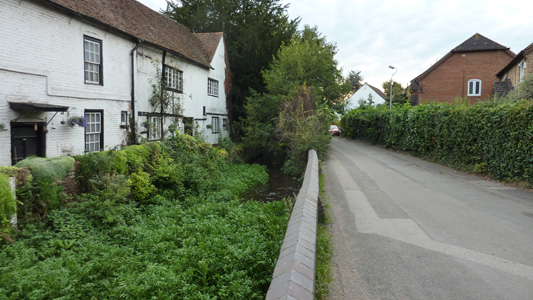
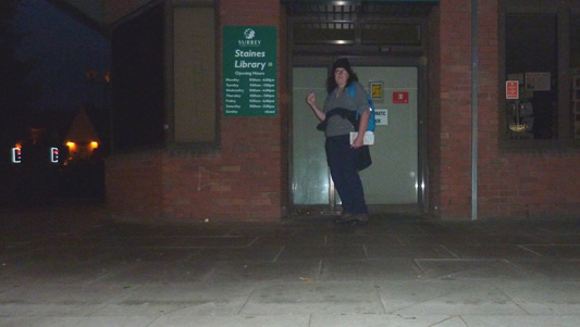
From Colnbrook along a dead end road by houses, following dead straight by field margins under a Heathrow flight path (low level flying shenanigans as the came into land) and joining the road at Horton, heading east to skirt the first mighty reservoir (Wraysbury) through Arthur Jacobson Open Space and a confusing section where I passed back over the M25 but got rather disorientated heading into Stanwell Moor. Found my next reservoir by deduction (King George VI) and followed along its western side (starting to go dark) across Staines Moor, a pleasant section with a meandering river, before passing under pylons and the A30 to pass down by a church to the River Thames and a short river walk to the town centre and railway station
Joining the Grand Union - West Drayton
Inauspicious start edge of West Drayton
The bridge, not marked on maps, that saved me a bit of legwork
The abandoned looking road leading to the railway underpass
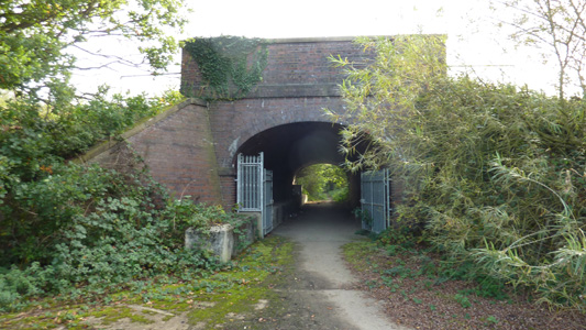
Under the mainline
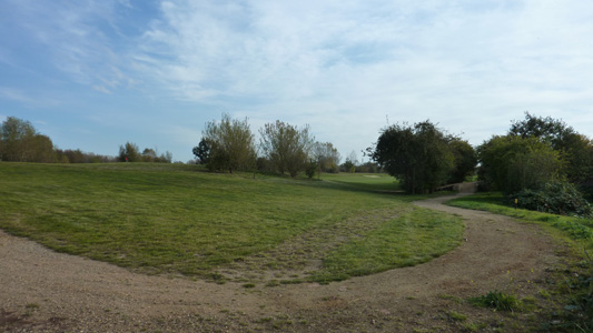
Pesky Golf Course
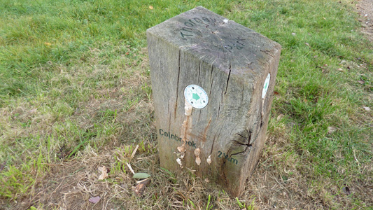
Wooden post with waymark in Thorney Park. Had to remove some mushrooms to read text!
Pleasant corridor by Motorway link road
Crossed the M25
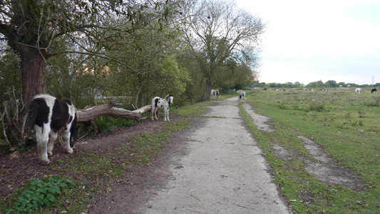
Lots of sweet horses near Colnbrook, just were very unkempt with matted hair and manes...
Rather nice spot at edge of Colnbrook
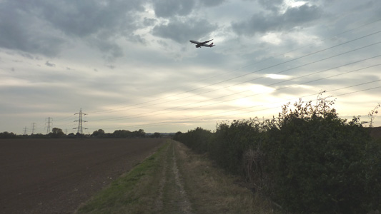
Lots of planes landing at Heathrow, crossing the flight path south of Colnbrook
Edge of Horton
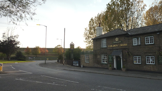
The Golden Cross Horton. Back wall of Wraysbury Reservoir in distance
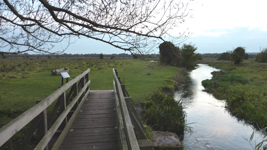
Staines Moor, getting dark but very pleasant
The Staines Massive
