[The Wey-South Path]
[The Essex Way]
[Links]
[Stour & Orwell]
[Thanet Coast Path]
[Grand Union]
[Wealdway]
[HWLT]
[SDW]
[Elham]
[Regents Canal]
[1066]
[SSW]
[PW NCP]
[Cotswold]
[SVW]
[DVP]
[SBP]
[Thames]
[SWCP]
[Gipping Valley River Path]
[Speyside]
[Three Castles Path]
[GGW]
[Eden]
[NDW]
[Capital Ring / Parkland Walk]
[MVW]
[The Loop]
[Ridgeway]
[TWC]
[RMCP]
[SMW]
[Fife Coastal Path]
[OVW]
[Vanguard]
[Lea Valley Walk]
[Resources]
[Greensand Way]
[The Monarch's Way]
[E2]
[Sandlings Walk]
[Solent Way]
[Weavers Way]
[Fynn Valley Way]
[Scafell Pike]
[Snowdon]
[Ben Nevis]
[Pentland Hills]
[Hangers Way]
[Staunton Way]
[Downs Link]
[Airdrie Bathgate Cycle Path]
[Thames Down]
[Marriot's Way]
[Bournemouth Coast Path]
[Forest Way]
[Icknield Way]
[Suffolk Coast Path]
[Angles Way]
[River Parrett Trail]
[New River Path]
[Stour Valley Path]
[St Edmund Way]
[Centenary Walk]
[John Muir Way]
[Paston Way]
[East Mendip Way]
[Orford Ness]
[Lindisfarne]
[Southern Upland Way]
[Berwickshire Coastal]
[Beverley Brook Walk]
[Chess Valley Walk]
[West Mendip Way]
[Strawberry Line]
[Colne Valley Trail]
[Hillingdon Trail]
[Huddersfield Canal Towpath Walk]
[Trans Pennine Trail]
[Pennine Way]
[North Berwick Law]
[Green Chain Walk]
[Ridgeway London]
[Waterlink Way]
[Greenwich Meridian Trail]
[Shuttle Riverway]
[Kelvin Walkway]
[Clyde Walkway]
[Union Canal Walk]
[New Lipchis Way]
[Brent River Park Walk]
[Dog Rose Ramble]
[Pymme's Brook Trail]
[Dollis Valley Greenwalk]
[Wandle Trail]
[Celandine Route]
[Paths to Prosperity]
[Paths to Prosperity Part Two]
Paths to Prosperity - Page Two - Walks 11 to 20 |

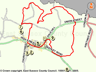
A series of 47 circular walks of varying length and difficulty, taking in the varied countryside of East Sussex, promoted by the County Council. I have previously been entirely fixated on Long Distance Walking / Waymarked routes, but as an additional source of walking mid week or when pushed for time these should hit the spot and give me an extra walking 'fix'! As and when completed they will follow underneath this table, which lists all the routes available. They also seem to be aimed at promoting the patronage of local businesses.
For Some reason, the walk numbering is not the same as alpha order, so I have decided to list them in the actual allotted walk number by ESCC.
Crowhurst walk 12
Wednesday 20 June 2012- 3.5 Miles (Including Link Paths)
ID20062012#34

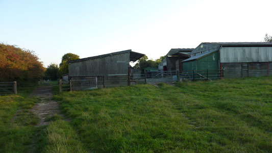
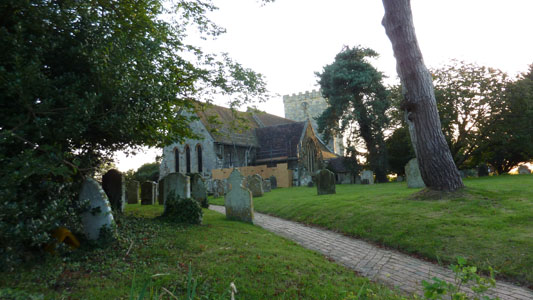
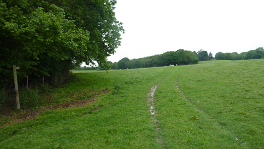
Another walky that I started from my gaff as Crowhurst is so local. Officially the walk commences from Crowhurst Station, so I cut cross country to reach it, then headed down Station Road, crossing by the Church to pass by the remains of a 13th Century Manor House forward through fields to walk by Powdermill Stream, with lots of critters trying to cool off, and entering a corner of Fore Wood Nature Reserve, where you follow a short section of 1066 Walk westwards then follow a circuit north and clockwise on permissive paths through the wood to walk by a deep Ghyll and after a while emerge near a pond with a bench back on the 1066 Walk at the East end of the wood. Here I had a quick breather, then walked back to Crowhurst Church on the 1066 Walk, before taking some new paths to me to get back to High Beech, taking me over the old Railway Line, but this was highly overgrown and even with GPS I could not find the path and had to cut through by a stables, but then onto Green Street then breadsell Lane from the south end and the usual walk back to home - job done
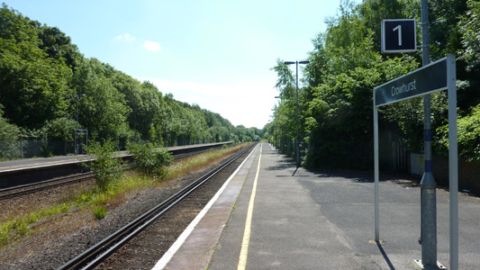
Crowhurst Station - my local
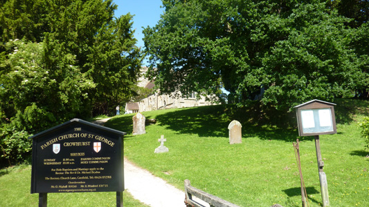
Crowhurst Parish Church - St George
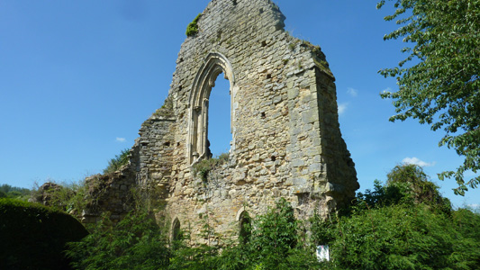
All that remains of the Manor House
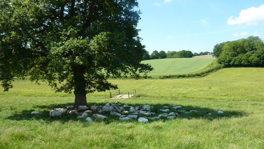
Hot and bothered sheeps

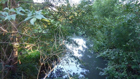
Powdermill Stream allegedly

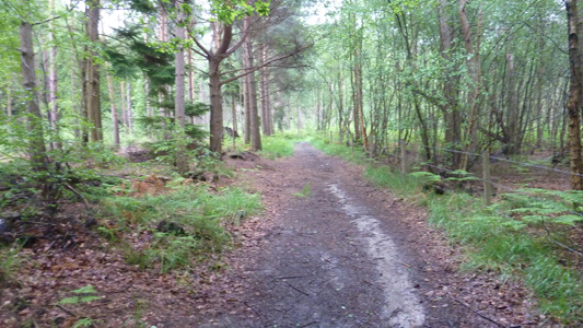
Fore Wood - the blissful shade
A mile of this stuff to navigate round - got a bit disorientating
After Fore Wood back towards Crowhurst - job done
Woods Corner walk 13
Wednesday 19 September 2012 - 3.5 Miles
ID19092012#51
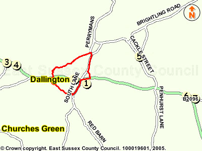
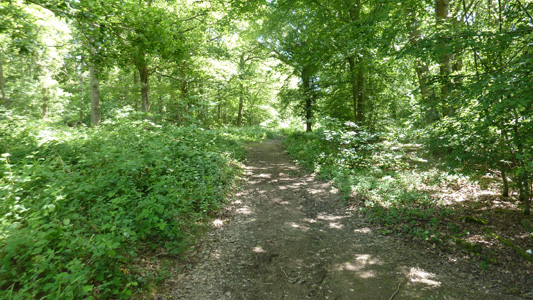
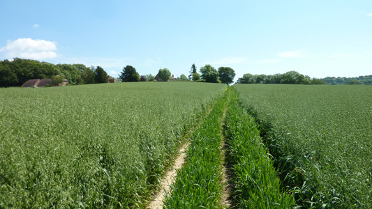
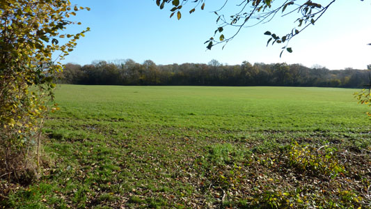
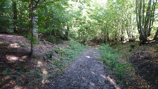
A quick walk between shifts at work. This week had been wonderful with lovely bright skies and some warmth and this was a very pleasant walk. From parking the car at Woods Corner, I followed South Lane off past the Swan Inn, then turning right on footpaths to cross a couple of fields, before passing through a woodland Shaw, then another field and enclosed path, to pop out on the road by Dallington Church. Not a village I had visited before, but all was lovely and peaceful on this beautiful sunny day. Next I crossed the road and took a downhill lane to reach the B2096. Almost straight across I followed an overgrown path to pass to the right of Brooklands, then at a path junction went right to reach a cottage, then on through a pleasant woodland stretch, across more fields, at a stables following a wood fenced path, at a path junction down a concrete path to cross a footbridge and then bearing right at a fingerpost, after a little bit more woodland coming out into a field which very soon led onto a gap in a hedge, and onto follow the driveway away from a property to soon reach a B road, where you turn right and then enter the Forestry Commision Deer Park, almost immediately following a path just behind the remains of the long but ruined wall that John 'Mad Jack' Fuller had built, along with his collection of follies. At the end of this wall, you pass through the entrance to a reclamation yard, then follow an enclosed path up a moderate hill, through into a field with 'The Sugar Loaf' - one of his folies in it. After perusing this impressive structure (meant to be the spire of Dallington Church) I then walked the very short distance to the road, turned right and headed back to my car - job done

The Swan Inn. Parked me mota opposite innit. You turn left immediately after

South Lane

Fileds near Dallington. Church spire on left of picture

Old powerline poles resused for horse jumping. Still got SEEBOARD safety warnings!

Dallington Church. A lovely peaceful little village

Path junction and woodland at Brooklands

Concrete track downhill after stables

More wood stuff at Brightling Down

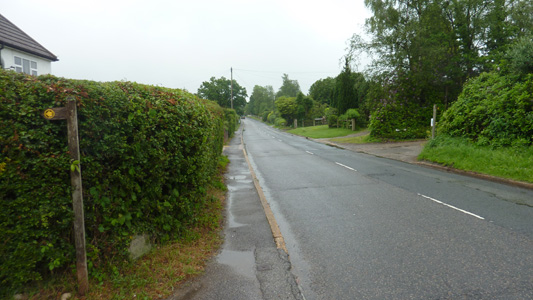
After the walk along the private track, a brief encounter with the Dallington Road. The sign towards camera points towards Batemans - the former home of Rudyard Kipling

Deer Park - You immediately turn right and follow behind the old wall

The very ruinous state of the estate wall of John 'Mad Jack' Fuller

Path up to the 'Sugar Loaf' by the reclamation Yard

Approaching the 'Sugar Loaf'

The outsdiee looking like Dallington spire apparently - this was bunged up by 'Mad Jack' because he had some drunken bet about being able to see the church from his gaff on his nearby estate at Brightling

Apparently it is 'Sugar Loaf' because suagar used to be sold in a cone shape and this folly looks a bit like one - allegedly

A view up inside to the top of the cone

Walking back to the motor. This is the main Heathfield road from Battle, but even though I have been a long here many times, I had never notice the 'Sugar Loaf' from the road before. Job done
Sandy Cross walk 15
Wednesday 14 November 2012
ID14112012#72

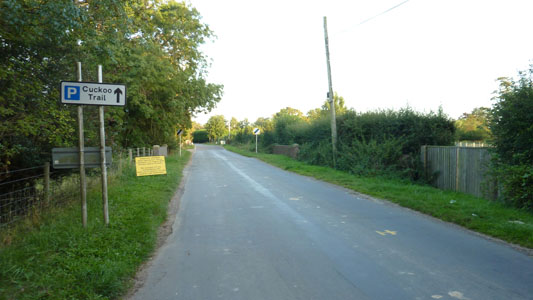
Another walk one between shifts. Not bad weather, but still very muddy. From the Runt In Tun pub, walking up into fields behind, then bearing to a farm track followed back to reach Sandy Cross Lane, with lovely views over to Old Heathfield. bearing left for a while then crossing the main road and then walking down Old Ghyll Road to bear left onto the Cuckoo Trail, followed for about half a mile, to pass sculptures and a picnic area, before then bearing back on a path to cross a filed between hedges, then immediately across the road back to the pub car park. A short but sweet walk and yet another ticked off the list

Runt In Tun and trusty steed
Muddy fields again
Lane to Sandy Cross with nice views
After Sandy Cross and main road, down Old Ghyll Road
On the Cuckoo Trail again
Someone has made a nice effort to remind people that this was once a useful railway line - Frenches Halt!
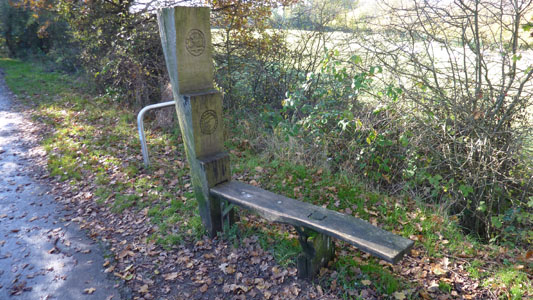
A bench / sculpture - the opposite side of the upright says 'Idea'
After brief reaquainteance with Cuckoo Trail, a path to the left after picnic area takes you shortly back to the pub
Hellingly walk 16
Wednesday 5 September 2012- 2 Miles
ID05092012#50c
Th last of today's trio of walks - I hust wanted to step up the pace of completing these wonderful little circulars. From the car park for the Cuckoo Trail at Hellingly Station, I followed the trail northwards for half a mile, crossing the river Cuckmere, before heading left away from the trail after a bridge to cross farmland - reaching Mill Lane and following this into the village and soon reaching Station Road again, and following this back to the car park - job done for today
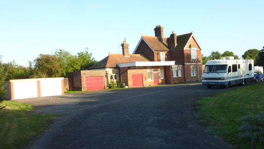
The erstwhile Hellingly Station
A Cuckoo on the Cuckoo Trail
Bridge over the Cuckmere
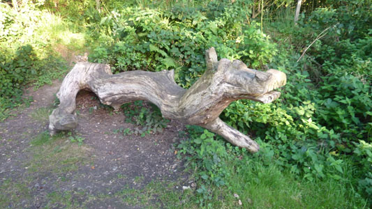
Dragon Sculpture
The bridge just before turning off the trail - a weird perspective comes across, as though it is a hill - obviously as a former railway this is not the case!

Leaving the trail to cross farmland
Pasing by farm buildings near Hellingly
Hellingly Church
Nearly back at the car - Station Road
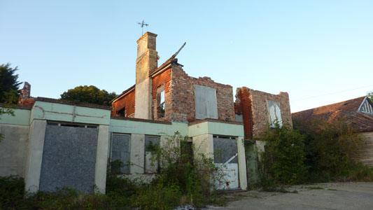
Sme burnt out old gaff by the old station - a real welcome awaits!
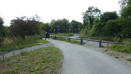
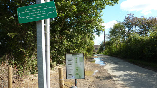
Summer Hill walk 17
Saturday 29 September 2012 - 2.5 Miles
(8 Miles Knockhatch Circular)
ID29092012#53

I was on a gig out at Knockhatch Adventure Park, so stymied on my usual weekend walk, I found that I could make up a circular to encompass the Summer Hill Walk, so I walked into Hailsham and then moseyed on down the Cuckoo Trail to Summer Hill, then followed on south for another mile to Sayerland Lane, where you briefly follow the lane, before joining a path on the right by a farm gate entrance thing, rather overgrown, following a path round to the left and then, beyond the stile, crossing the field, to reach a small bridge and stile, along the field edge path keeping the hedge on your right. At the field corner, crossing the stile, and following the edge of the next field. After the stile in the next field corner, following the cross field path as waymarked, heading towards another stile. Continue to follow the path in the same direction, crossing a further stile. After passing the farm buildings, a path junction is reached. Turning right and follow the edge of this field. After crossing the stile at the field boundary, continuing along the edge of the next field, keeping the hedge on your left. Approximately half way along the field edge, turning left into the woodland and following the waymarked path for a short distance, before joining a surfaced track. Continuing to follow this track, passing some fishing lakes, before turning right at the footpath signpost. After reaching the next stile, the path crosses the field to some steps set in a small bank. At the footpath junction on the far side of the field, turn right to follow the field edge path, keeping the hedge on your left. At the far end of the field, following the path down the steps, and turning left, crossing the stile, before descending the steps to re-join the Cuckoo Trail. I then walked back up to Hailsham and walked on paths to cross the A22 slightly more south, to walk along the lane passing Arlington Speedway Circuit, then taking a bridgelway on the right, leading to the entrance of Knockhatch

Obviously not spotted on the walk itself, but I thought you might like to see these Wallabies I spotted at Knockhatch just before the walk

Joining the Cuckoo Trail at Hailsham

South of Hailsham an old railway milepost
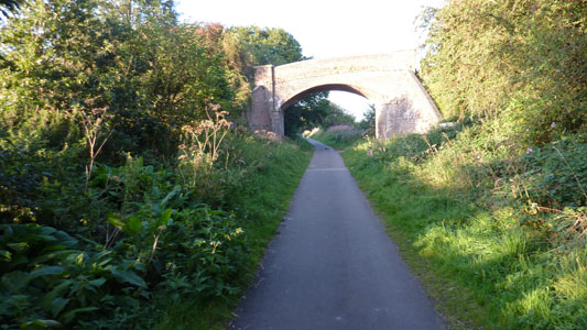
Ugly road crossing of the B2104 - erstwhile level crossing
Must be Summer Hill Lane then
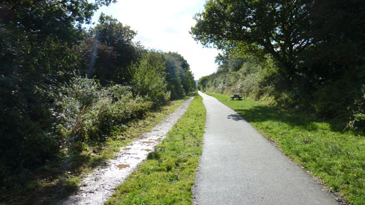
Lovin it in the sun south of Summer Hill
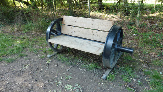
Lovely bench with railway wheels
Peeling off the Cuckoo Trail at Sayerland Lane
Crossing Farmland towards Nightingale Farm
The section followed away from the Cuckoo Trail has also been previously used as a Cuckoo Trail diversion, but the overgrown nature of this section suggests that was not recently
Surfaced track near fishing lakes
Back at the Cuckoo Trail again
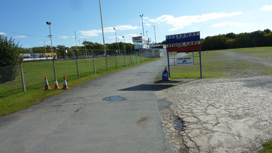
After walking back up the Cuckoo Trail and cutting across the A22 I walked to Arlington Stadium on the way back to Knockhatch
Byway back to Knockhatch
Ticehurst walk 20
Wednesday 6 June - 7 Miles
ID06062012#32
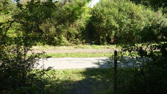
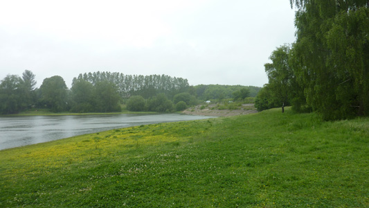
This was a walk completed during the summer half term, but the weather had been pants and I entered into the walk expecting to get soaked - and was like a swamp fing by the end of it, but the walk itself was very interesting, passing from the square in Ticehurst to Old Hazelwood, then lane walking to near Huntley Mill Lane, then soon reaching the southern edge of Bewl Water (yet another reservoir) - apparently 'the largest stretch of open water in South East England' . Anyway there is a waymarked Round Bewl Water Walk, and I followed this for half hour or so (I lost track in the rain) until reaching the dam wall itself at Rosemary Lane, here Joining the Sussex Border Path and following it through Ketley Wood to Union Street. Across the road and down past a house named 'Quedley' to pass over another arse aching golf course, fortunately no one playing and entering woodland to soon leave the SBP on its edge and head to Birchenwood Farm. A short section along the fst moving B2099 then off to the right, dipping back down towards woodland and crossing a couple of fields reaching another bloody golf course, although the solitary player was very polite and beckoned me across! I was enchanted by a couple of horses frollicking in a paddock, before walking along the Road at Dale Hill the short distance back into Ticehurst and rejoining the mota
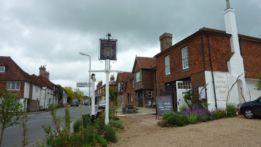
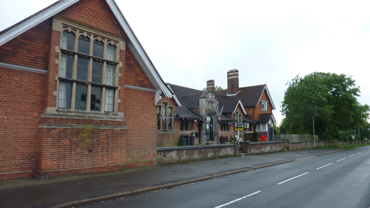
The Bell, Ticehurst, storm clouds brewin'
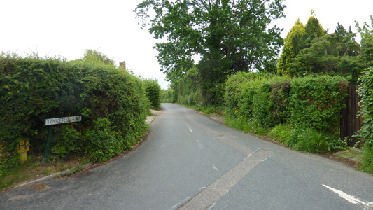
Tinkers Lane
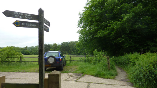
Following the Round Bewl Walk
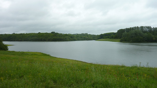
A lump of Bewl Water. It is a very crenulated shoreline reservoir, and I remember going on the boat from the visitor centre and getting a bit disorientated like
The dam wall at Rosemary Lane - bleedin soaked now
Ketley Wood
Union Street
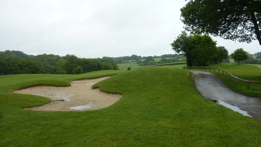
Pesky Golf Course near Quedley
Leaving the SBP
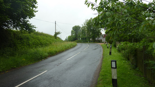
Dodgy bit on the B2099 near Ticehurst
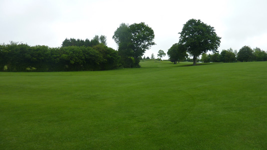
Anuva Golf Course - edge of Ticehurst
Ticehurst - Job Dun
