[The Wey-South Path]
[The Essex Way]
[Links]
[Stour & Orwell]
[Thanet Coast Path]
[Grand Union]
[Wealdway]
[HWLT]
[SDW]
[Elham]
[Regents Canal]
[1066]
[SSW]
[PW NCP]
[Cotswold]
[SVW]
[DVP]
[SBP]
[Thames]
[SWCP]
[Gipping Valley River Path]
[Speyside]
[Three Castles Path]
[GGW]
[Eden]
[NDW]
[Capital Ring / Parkland Walk]
[MVW]
[The Loop]
[Ridgeway]
[TWC]
[RMCP]
[SMW]
[Fife Coastal Path]
[OVW]
[Vanguard]
[Lea Valley Walk]
[Resources]
[Greensand Way]
[The Monarch's Way]
[E2]
[Sandlings Walk]
[Solent Way]
[Weavers Way]
[Fynn Valley Way]
[Scafell Pike]
[Snowdon]
[Ben Nevis]
[Pentland Hills]
[Hangers Way]
[Staunton Way]
[Downs Link]
[Airdrie Bathgate Cycle Path]
[Thames Down]
[Marriot's Way]
[Bournemouth Coast Path]
[Forest Way]
[Icknield Way]
[Suffolk Coast Path]
[Angles Way]
[River Parrett Trail]
[New River Path]
[Stour Valley Path]
[St Edmund Way]
[Centenary Walk]
[John Muir Way]
[Paston Way]
[East Mendip Way]
[Orford Ness]
[Lindisfarne]
[Southern Upland Way]
[Berwickshire Coastal]
[Beverley Brook Walk]
[Chess Valley Walk]
[West Mendip Way]
[Strawberry Line]
[Colne Valley Trail]
[Hillingdon Trail]
[Huddersfield Canal Towpath Walk]
[Trans Pennine Trail]
[Pennine Way]
[North Berwick Law]
[Green Chain Walk]
[Ridgeway London]
[Waterlink Way]
[Greenwich Meridian Trail]
[Shuttle Riverway]
[Kelvin Walkway]
[Clyde Walkway]
[Union Canal Walk]
[New Lipchis Way]
[Brent River Park Walk]
[Dog Rose Ramble]
[Pymme's Brook Trail]
[Dollis Valley Greenwalk]
[Wandle Trail]
[Celandine Route]
[Paths to Prosperity]
[Snaefell]
Mount Caburn |

Mount Caburn is a 480-foot (146m) isolated peak, one of the highest landmarks in East Sussex, England, about one mile (1.6 km) east of Lewes overlooking the village of Glynde. It is an isolated part of the South Downs, separated by Glynde Reach, a tributary of the River Ouse
Glynde to Lewes
Saturday 19 May 2012 - 4 Miles
ID19052012#28c
Third walk of the day and was just a last minute brainwave to do this after completing the two Path to Prosperity Walks. From Glynde Station I walked along Lacys Hill, crossing Glynde Reach at the bridge, then turning left into Ranscombe Lane before shortly bearing right on a path heading uphill roughly North West, passing through a field gap and following by a fence to bear towards Mount Caburn. At a junction of paths I turned left to head directly onto the summit where an Iron Age Fort once stood, with its ditch defence still easily defined. I was lucky enough to be completely undisturbed while sitting atop a strategically placed bench with breathtaking views and a wonderful panorama over the A26/27, railway and a good sweep of the South Downs, and 'loitered' for a while drinking it all in (and having a bit of chuck to boot). Often, the local Paragliding Clubs are seen launching into the abyss from this hill Anyway, I retraced my steps back to the path junction, and then headed downhill, passing some cows and a farmers fenced pond before bearing round to the West, and very shortly heading uphill again, aiming to the top of Cliffe Hill and bearing away from the public footpath, going rogue to reach the trig point on the Golf Course - fortunately it was late in the day, and I didn't have the usual arseache of mixing it with golfers, and had a breather sitting by the trig (164 Metres) before heading slightly back downhill, to follow another path running through the course to soon have views over Lewes, and after checking out the Obilisk, headed on a path down into Lewes, down Chapel Hill and along Cliffe High Street to soon reach the station and back home after a lovely three part walk after the two path to prosperity walks of Arlington and Ripe. As an unusual extra here is the gpx tracklog
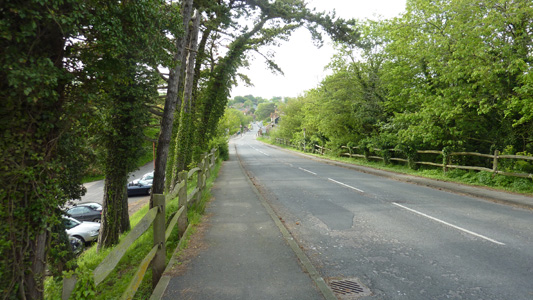
Walking from Glynde Station along Lacys Hill
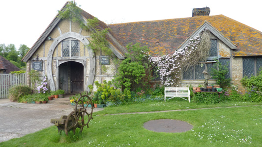
Interesting Blacksmiths building
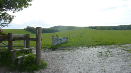
Long Uphill to pass through gap at top of fence
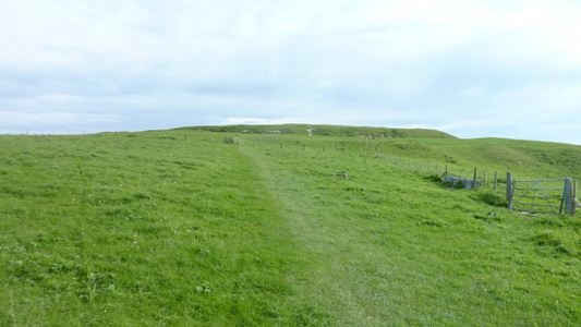
Bearing towards the Iron Age Fort Site
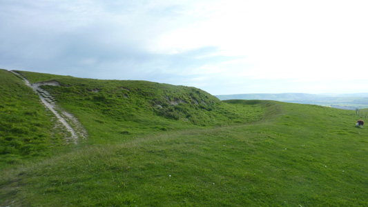
Clearly defined ditch
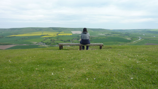
Mental Enema time
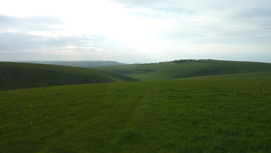
After retracing steps now headed towards Cliffe Hill
After hitting the valley floor, bearing to the left and then uphill after the pond
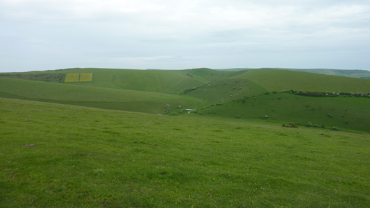
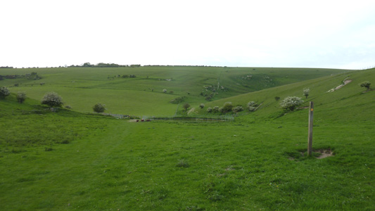
From Cliffe Hill looking back South towards Mount Caburn - Pond from previous location middle of picture
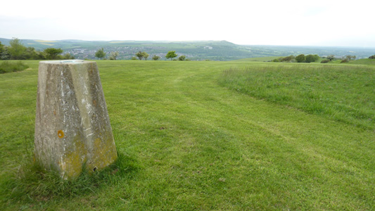
Cliffe Hill Trig - Slap Bang on the Golf Course
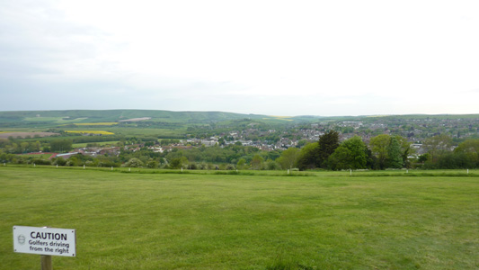
Descending towards Lewes
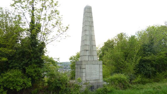
The imposing Obelisk to the memory of 17 Protestant Martyrs burned to death under the reign of Queen Mary. A fitting tribute, but of course Catholics also shared the same fate, that's why I have no faith (sic) in religion
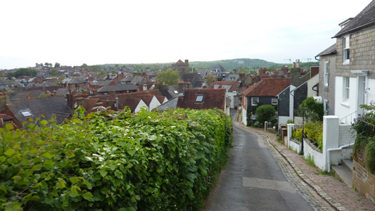
Chapel Hill
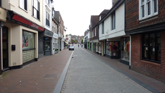
Cliffe High Street, almost at Lewes Station and then home
