|
[The Sussex Diamond Way]
[The Wey-South Path] [The Essex Way] [Links] [Stour & Orwell] [Thanet Coast Path] [Grand Union] [Wealdway] [HWLT] [SDW] [Elham] [Regents Canal] [1066] [SSW] [PW NCP] [Cotswold] [SVW] [DVP] [SBP] [Thames] [SWCP] [Gipping Valley River Path] [Speyside] [Three Castles Path] [GGW] [Eden] [NDW] [Capital Ring / Parkland Walk] [MVW] [The Loop] [Ridgeway] [TWC] [RMCP] [SMW] [Fife Coastal Path] [OVW] [Vanguard] [Lea Valley Walk] [Resources] [Greensand Way] [The Monarch's Way] [E2] [Sandlings Walk] [Solent Way] [Weavers Way] [Fynn Valley Way] [Scafell Pike] [Snowdon] [Ben Nevis] [Pentland Hills] [Hangers Way] [Staunton Way] [Downs Link] [Airdrie Bathgate Cycle Path] [Thames Down] [Marriot's Way] [Bournemouth Coast Path] [Forest Way] [Icknield Way] [Suffolk Coast Path] [Angles Way] [River Parrett Trail] [New River Path] [Stour Valley Path] [St Edmund Way] [Centenary Walk] [John Muir Way] [Paston Way] [East Mendip Way] [Orford Ness] [Lindisfarne] [Southern Upland Way] [Berwickshire Coastal] [Beverley Brook Walk] [Chess Valley Walk] [West Mendip Way] [Strawberry Line] [Colne Valley Trail] [Hillingdon Trail] [Huddersfield Canal Towpath Walk] [Trans Pennine Trail] [Pennine Way] [North Berwick Law] [Green Chain Walk] [Ridgeway London] [Waterlink Way] [Greenwich Meridian Trail] [Shuttle Riverway] [Kelvin Walkway] [Clyde Walkway] [Union Canal Walk] [New Lipchis Way] [Brent River Park Walk] [Dog Rose Ramble] [Pymme's Brook Trail] [Dollis Valley Greenwalk] [Wandle Trail] [Celandine Route] [Paths to Prosperity] [Snaefell]
|
Stour Valley Path
The Stour Valley Path is a 96-kilometre (60 mi) long-distance footpath in Suffolk, England, from Newmarket to Cattawade, a village near Manningtree. The path follows the catchment area of the River Stour. The majority of the route forms part of European Path E2. It connects with the Icknield Way, the Suffolk Coast and Heaths Path and the Essex Way.
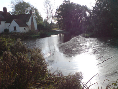
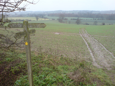
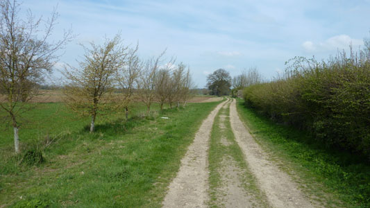
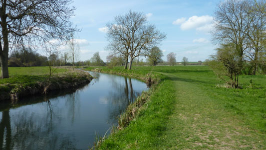
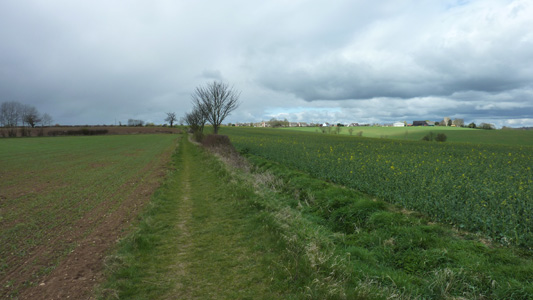
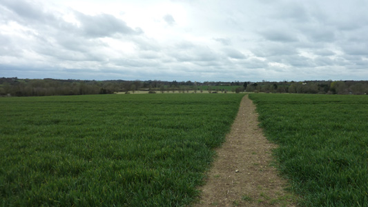
Flatford Mill to Stoke By NaylandSaturday 7 November 2009 - 8 MilesID07112009#33b The second path of today's walk - the first being along the St Edmund Way to Flatford from Manningtree Station avoiding the very first sliver of this path from Cattawade. Officially hooked into this walk at Flatford Mill, after having a look at the river by the mill represented in Constable's 'The Hay Wain'. Whilst I am not a fan of his paintings, Flatford is a lovely setting and I vaguely remember going there as a sprog and getting a packet off an electric fence, as I couldn't grasp the meaning at the time! Anyway, continuing along by the Stour passing on the opposite bank to Dedham and eventually reaching the A12, where you pass underneath and then come up to Stratford St Mary. You then come back to the Stour and cross several fields, before joining a farm track and crossing the B1087 east of Thorington Street. You then start to climb on another track and paths, past Eastfields Farm - (nearby a bunch of numbnuts were brushing for pheasants) and with the coountryside now becoming quite undulating, eventually reaching the B1087 again on the edge of Stoke by Nayland. Unfortunately I did not have enough time to reach Nayland before my bus was due. Instead had a leisurely skoff break by the beautiful church and 'chilled' for an hour before the bus to Colchester Station. A beautiful sunny, but cold day, walking through stunning countryside that I long to get back to asap
Where the 'Hay Wain' painting by Constable was located
The Hay Wain, shows some artistic license, such as the roofline adjustment to Willy Lott's Cottage and a changed landscape. According to wikipedia, the water level has risen due to East Angular (sic) sinking a foot or so since the picture was created!
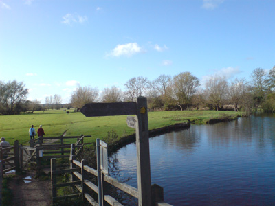
Follow the Stour towards Dedham, with the 'fair weather' walkers!
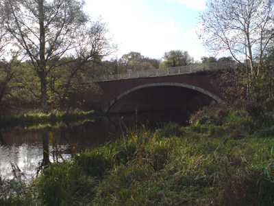
Bridge for the A12 to enter Essex
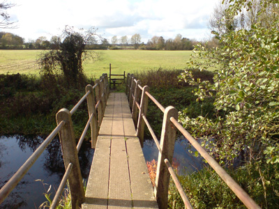
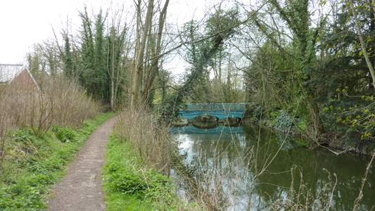
Footbridge near old lock at Stratford St Mary
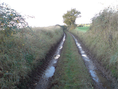
Muddy track shenanigans (need 4x4 boots) south of the B1068
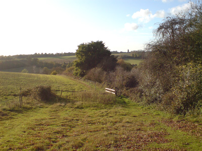
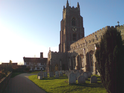
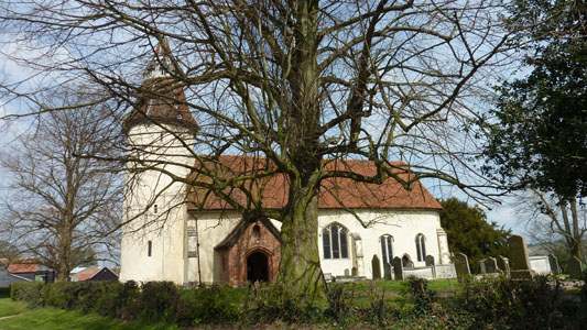
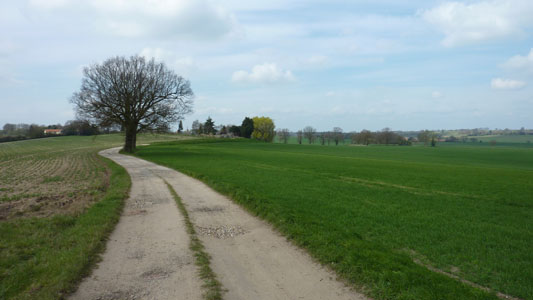
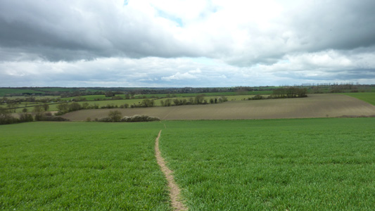
The path becomes increasingly undulating, and very attractive towards Stoke by Nayland. This is all Dedham Vale. Stoke By Nayland Church peeping over the hill between the two trees
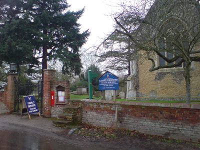
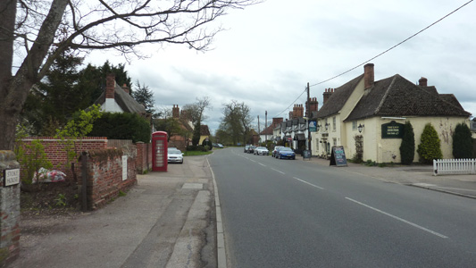
A very pleasant village - Stoke By Nayland. Chav free and a beautiful church, where I had my late lunch and killed an hour waiting for my bus
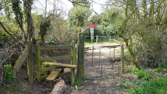
Stoke By Nayland to BuresTuesday 29 December 2009 - 8.75 MilesID29122009#36 Another great Xmas walk. After a lovely Monday chilling, made this the last walk before heading back home on Wednesday. Train/bus to Stoke By Nayland. Straight on from the church, turning left at Beacham's Farm, down to Nayland and then passing south parallel with the Stour, past an impressive weir. Crossing the A134 Colchester - Sudbury road, then shadowing the Stour past Wiston Mill (i wanted a picture of this impressive structure, but a posho has made access impossible without trespass) - turning left over a river bridge (parting company with the St Edmund Way) and through woodland, then climbing (at the time) a very muddy steep field that sapped my energy, and it was starting to rain as well, but then along a ridge at the top with great valley views, passing north of Little Horkesley, then meandering towards Wormingford, where lunch was had in the graveyard, before pushing on North West, passing back over the Stour at the beautiful Bures Mill (another private residence) and shortly joining the road on the outskirts of Bures. By this time I was getting soggy and fortunately only had a brief wait for a train back towards Colchester on this sad truncated line. A long wait at Marks Tey, then back to mums for dinner...
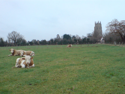
Cows chillin' at Stoke By Nayland
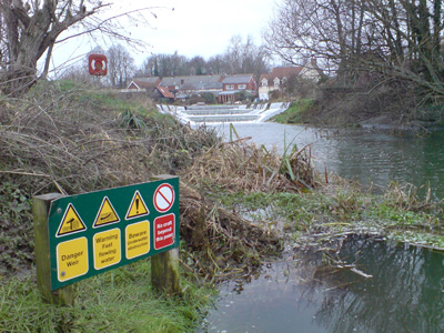
Weir - Nayland
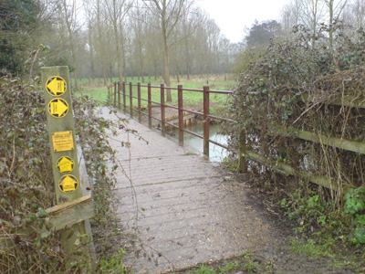
Parting company with the St Edmunds Way (no marking) near Wiston Mill
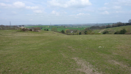
Nasty muddy field - my boots grew muchly in weight, but then onto a ridge
Wormingford Church - a welcome rest
Bures Mill - nice gaff
Bures - job done
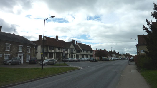
Bures to Long MelfordThursday 15 April 2010 - 10 MilesID15042010#13Last walk of my two week break - from Bures northwards near the river Stour, passing through Lamarsh, a bit of lane walking, then a meandering course, eventually reaching Sudbury via Ballingdon. A very lovely walk through the edge of Sudbury on the floodplain - then joining the trackbed of the erstwhile railway to Cambridge at Brundon. A pretty walk eventually joining the road west of Rodbridge Corner, then north East, crossing a lane near Liston and then cutting across flood plain to finish in Long Melford (Last visit in 1991). I rather disappointed myself with such a short walk, but I would not have made it to Glemsford in time for the last bus, and I was getting a bit of walk fatigue after 5 walks whilst on holiday. Caught bus back into Sudbury and hung out for an hour to get a bus back to Trimley.
Track near Bures
Railway Line near Bures
Lamarsh Church
Lovely vista near The Valley Farm
Track - Hickbush
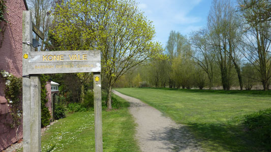
Kone Vale - Edge of Sudbury
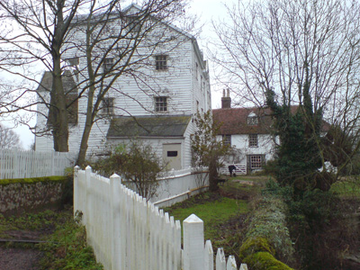
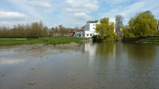
Sudbury Mill. A beautiful setting now a Hotel
The STP joins the valley way - the old railway trackbed, where the truncated railway now ends at Sudbury
Rejoining the Stour at Liston, after some road walking. Shortly afterwards you bear off North-East into Long Melford - where I finished my walk
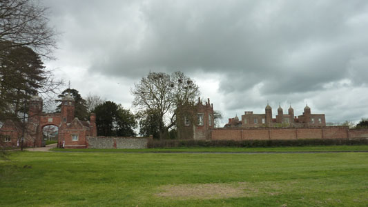
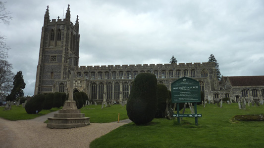
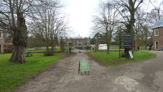
Long Melford to Baythorne EndSaturday 7 April 2012 - 14 MilesID07042012#18 Another jolly to Suffolk, while on Easter Break. Headed up from East Sussex on the red eye and reached Long Melford about 1030. A glorious walk through beautiful countryside and through very touristy villages, from Long Melford passing Melford (the St Edmund way peels of here towards Lavenham) and Kentwell Hall (some jousty shenanigans in progress at Kentwell) then along to Glemsford, then Cavendish, then Clare, Stoke by Clare and finally Baythorne End, not touristy particularly, but as far as I could get before catching the last bus to Sudbury and going on to me mams for Easter (and a choccy egg). Appalled to realise this walk was almost 2 years since last section, so must get jiggy to Newmarket in Summer
Long Melford - It sure has a long main street - no Greggs though!
Melford Hall - National Trust. I'm a member, but no time to explore on this occasion. Just got an eyeball while munching my Egg Bap from the Co-op!
Holy Trinity Church
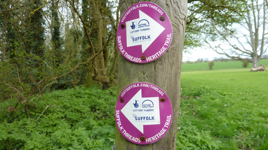
I looked this up afterwards and it is one of seven walks, each around one of Suffolks historic 'wool towns' http://www.visitsuffolk.com/threads/
Kentwell Hall - lots of punters were piling in for some Easter Shenanigans
Glemsford approach...not a place I know much about, and you only briefly pass through it
Lovely rolling countryside - with Cavendish Church in far distance
Cavendish. Took Piccy and 'turned and burned' onwards (sorry, too much Ice Road Truckers!)
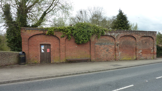
I was intrigued by this wall on the edge of Clare (as you do) It looks like it used to be part of something far more significant, maybe a Mill?
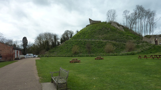
Five minutes on you come across the sad remains of Clare Station, although it was a good place for a bit of nosebag and a breather
Parked my carcass by Clare Castle
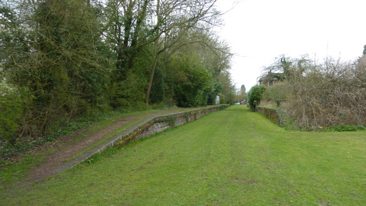
Pretty bridge over the Stour, on the brief section of destructed railway line
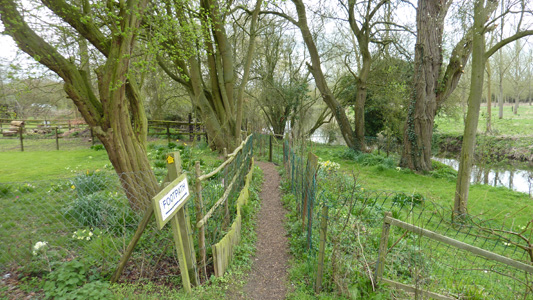
Then you go through some gardens...
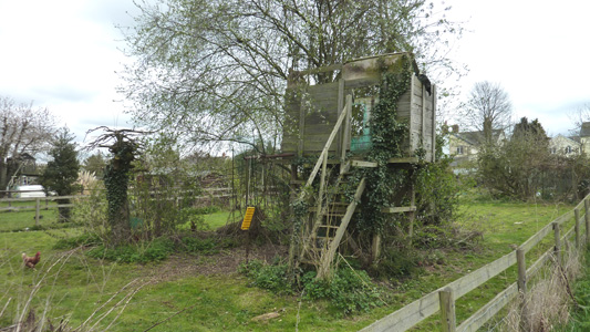
Someone has let the Tree House go to pot, maybe the sprogs grew out of this activity many years ago...
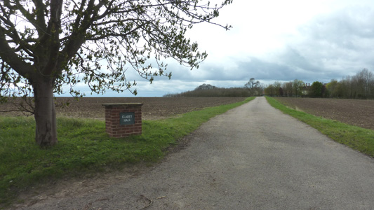
Claret Hall after a small road walk away from the River
After going wrong for ten minutes, got back on track towards Stoke By Clare...a combination of the batteries on My Memory Map going South and a lack of belief in the GPS fixing on my Galaxy meant a frustrating mistake, but I guess I should also pay more attention as well
Stoke By Clare. A very quick calculation (CSE maths) seemed to indicate that I could keep on truckin to Baythorne End before the bus was due...
Driveway of Baythorne Park, a posh gaff innit. At end of driveway, hung a right and right again very quickly into Mill Road and a short wait for the very welcome bus out of Dodge. Trimley beckons! |